


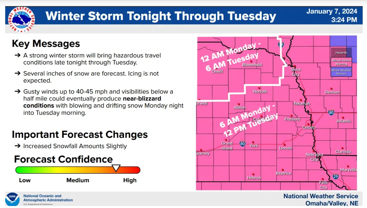
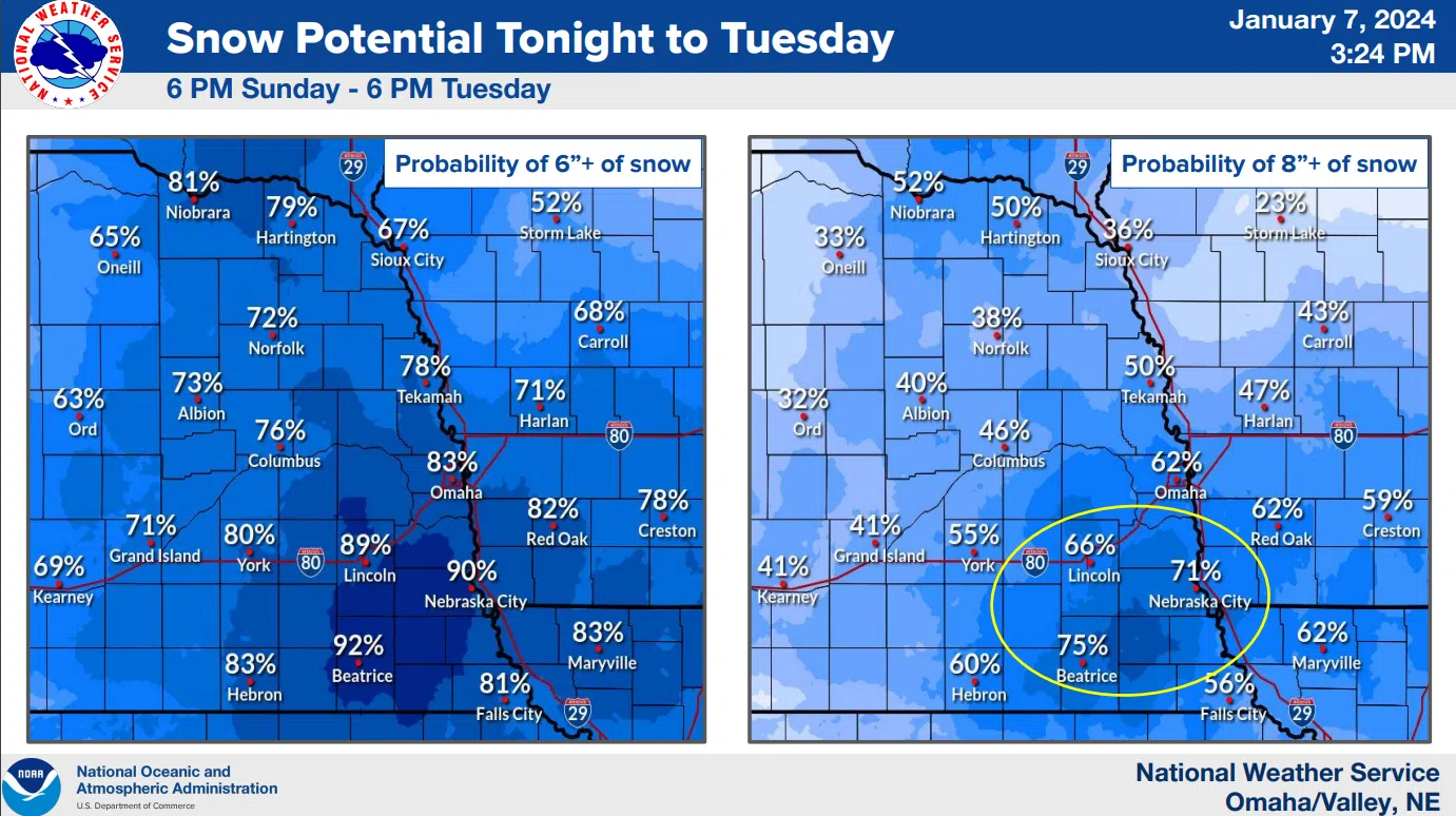
The National Weather Service Sunday afternoon held a public service/public safety/media webinar on the approaching winter storm. The latest forecast models show increased amounts of snow likely in SE Nebraska with the Lincoln area possibly receiving between 7 and 11 inches by early Tuesday. Higher amounts are possible to the South and East of Lincoln.
 It is expected that Lincoln could begin around 6 am Monday with a wintry mix of precipitation that will change to all snow by mid-morning Monday. Snowfall rates of 1 to 2 inches per hour are possible during the day Monday. Winds will be out of the East/Southeast in the morning from 10 to 20 mph but by Monday evening will switch to the Northwest and pickup to 25 mph and higher with gusts of 40 to 45 mph possible. This could cause some near-blizzard-like conditions.
The initial snow is expected to be wet and heavy with drier and lighter snow possible later in the day which could cause much reduced visibility in the higher winds. While the Monday morning commute could see some travel delays the evening commute is expected to be much more difficult.
By late week, sharply colder conditions are expected across the region with bitterly cold temperatures forecast for the weekend.. Saturday night into Sunday morning Lincoln could experience wind-chills as low as -32 degrees.
The mid-Sunday afternoon expanded NWS information is available here 1-7-24 NWS PM DssPacket