


…WIND ADVISORY IN EFFECT FROM 6 AM THIS MORNING TO 6 PM CST THIS EVENING…
Southwest winds sustained at 20 to 30 mph with gusts of 50 to 55 mph expected in the afternoon.
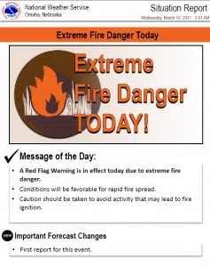
Gusty winds could blow around unsecured objects. Tree limbs could be blown down and a few power outages may result. Very high to extreme fire danger is also expected in these areas.
Use extra caution when driving, especially if operating a high profile vehicle. Secure outdoor objects.
Additional Information:
Winds will gust to around 45 mph for much of the day, especially south of a Seward to Fremont to Denison line, with gusts up to 55 mph expected for a few hours this afternoon.
The very strong winds, low humidity, and dry fuels will lead to extreme fire danger in southeast Nebraska and southwest Iowa.
Thursday through Tuesday several rounds of precipitation are expected from Saturday through early next week. Some of this will come in the form of heavy rain, but several inches of snow is also possible in parts of the area with the main uncertainty being in just where that snow will fall.


