


NWS
Scattered light showers moved through the Lincoln metro early Monday morning while heavier showers were reported in Northeast Nebraska.
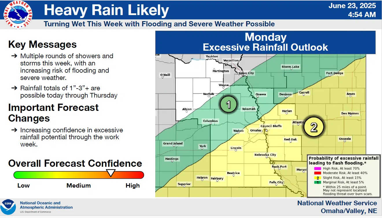
A cold front moving through the State will be the focal point for showers and thunderstorms to develop in the area this afternoon. Thunderstorm development is expected along and south of I-80 and could bring localized flooding and damaging wind gusts of 60 to 70 mph.
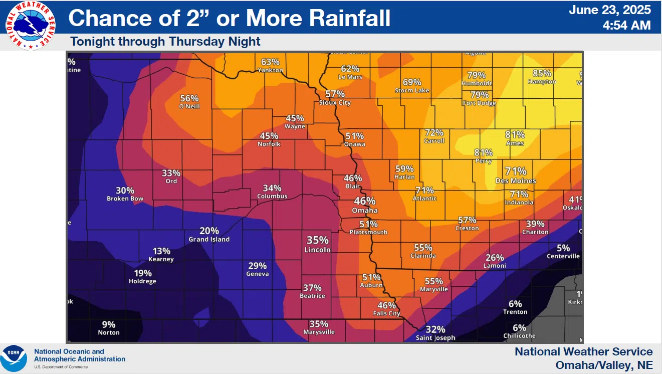
The cold front is forecast to remain in the region through Thursday which will bring a chance of more showers and thunderstorms. The latest NWS details and maps are available here 6-23-25 NWS AM DssPacket