


While Lancaster County sits just outside of Thursday evening’s tornado watch zone, the National Weather Service in Omaha/Valley is urging residents to stay alert as storms begin to develop across Nebraska.
Lead Meteorologist Laurel McCoy told KLIN News that a large complex of storms is expected to form over northeast and south-central Nebraska over the evening hours.
“These are going to merge and turn into a big line of storms moving across eastern Nebraska into western Iowa late tonight,” McCoy said.
Severe weather threats include damaging winds, large hail, and a brief tornado or two — though those threats are forecast mainly north of Lancaster County.
As the system progresses, McCoy said the storm threat will transition into a heavy rainfall event overnight into early Friday morning, potentially lasting until around 7 a.m.
“All threats are possible through tomorrow morning,” McCoy said.
Friday may also see another round of scattered storms in the afternoon, with slightly lower chances for severe weather.
“Probably not as good a chance of severe weather as we’re seeing today,” McCoy said. “But we could still see some strong winds and quarter-sized hail.”
McCoy also warned that with saturated ground from overnight rain, flash flooding could be a concern for areas that see repeat storms.
As for Lincoln and Lancaster County, the National Weather Service estimates about a 30% chance of storms on Friday, with the higher chances just to the east.
McCoy emphasized the importance of staying weather-aware and having multiple ways to receive warnings, especially overnight.
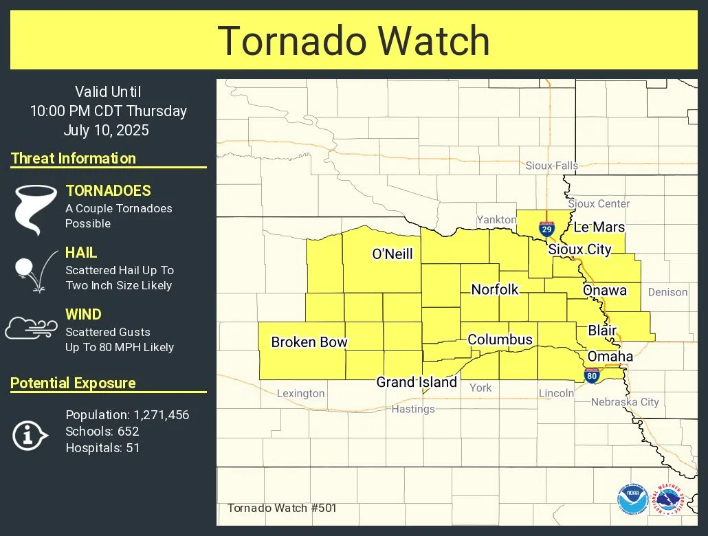
National Weather Service Omaha/Valley